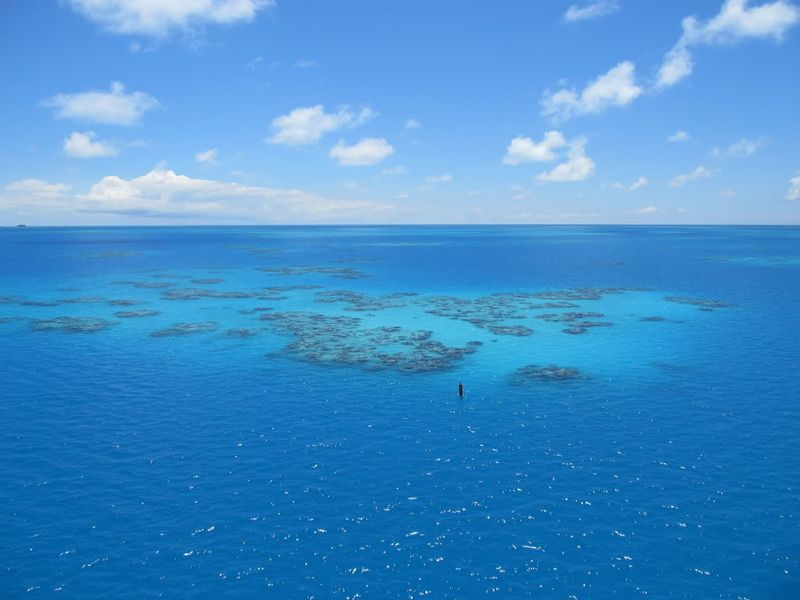
The British overseas island of Bermuda is a group of low-forming volcanoes in the Atlantic Ocean, near the western edge of the Sargasso Sea. It is the northernmost point of the Bermuda Triangle where, according to legend, a number of aircraft and surface vessels have disappeared under supposedly unexplained or mysterious circumstances.
Our family enjoyed a cruise from New York to Bermuda. Our first day on the island included snorkeling and paddling at Snorkel Park Beach. It was very windy and we had a nice little surf to play in out by the buoys which marked off our beach zone. There was a storm just off to the left in the picture above. Although it got much darker and ominous, fortunately, it never came any closer.
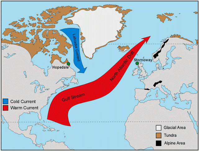
Bermuda’s upper layer was built by corals that thrive in the clear, warm waters pulled up by the Gulf Stream. The Gulf Stream that runs through the Bermuda Triangle is swift and turbulent. It flows at 4 to 5 knots along the shelf break until it deflects out over the open ocean off Cape Hatteras. A constant succession of massive eddies and upwellings peel off the Gulf Stream’s western wall, carrying life from the tropics to the temperate sounds of North Carolina.
The ocean floor has shoals around islands as well as some of the deepest marine trenches in the world. Uncharted navigational hazards abound as strong currents interact with reefs creating a constant flux.
It is here that rogue waves 80 feet or higher occur with regular frequency. Rogue waves could be one possible explanation for the loss of many of the ships.
The University of Southern Florida reports that the sandy bottoms of Florida beaches are constantly shifting shape and making them more vulnerable to rip tides. U of SF also reported that researchers found, in most cases, it was wind-driven waves towards the beaches that produced the conditions leading to rip currents. (8)
Rip currents can be dangerous if you are not familiar with them, but most surfers learn to paddle out right in the middle of rip currents to catch a ride out to the break, and then surf right alongside them. YouTube: Rip Tides. Surfers actually use rip tides to help bring them out to the waves. They can also help rescue a swimmer caught in a rip tide. Charles Paxton, Science & Operations Officer for the National Weather Service and avid surfer who has studied the area, explained that the rip currents are formed when water from breaking waves that has collected in the shallows is funneled seaward through a narrow channel, creating a powerful stream of water that swimmers can’t see and don’t know is there until they are in it. (8)
Although it is a haven for surfers, locals at Sagres Beach on the Algarve said tourists frequently get into trouble because strong currents create hidden whirlpools around a large rock in the middle of the bay. The water is especially dangerous because it is where the Mediterranean Sea meets the Atlantic Ocean, meaning waves can change quickly, catching swimmers unaware. (2)
Earlier this year I went on a kayak expedition around Georgia’s Cumberland Island and kayak surfing was one of my favorite memories from the trip. People who like to surf, including kayak surfing, will look for the shoals where waves break.
Mary R. Bullard, author of “Cumberland Island: A History,” writes, “… the entrance to St. Andrew’s Sound from the ocean was considered dangerous…. mariners were often reluctant to cross it because it was full of shoals… you enter over a shifting sandbar that extends about five miles offshore. Two large rivers, the Great and Little Satillas, empty into the sound carrying thousands of pounds of silt, which means the sound changes its underwater configuration with dangerous rapidity. Sandbars appear and disappear with no particular evidence.” (1)
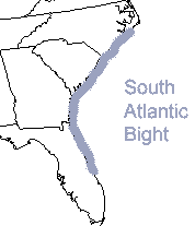
Cumberland Island is located in the South Atlantic Bight (gradual bend that forms a large, open bay). This is the name given to describe the U.S. coastal ocean from North Carolina to the east coast of Florida. Rock reefs covered with attached algae and animals makes up to 20% of the bottom of the continental shelf found in the South Atlantic Bight. (1)
“…Be Careful Surf Kayakers–Rougher chop and more dangerous conditions than usual are par for the course for South Florida seas in the winter. This weekend will prove the point with a storm system off the East Coast which is predicted to bring in heavy winds, waves, and rip currents. While this will undoubtedly (and thankfully) keep many out of the water this weekend, it could be an opportunity for some surf kayaking…” (12)
References
1. Cumberland Island: A History, by Mary R. Bullard; U of Georgia Press, 2005; p. 7.
2. Algarve Drowning–Sagres Beach, Portugal. Mail Online UK ; 10/7/2009.
3. The Gulf Stream ; wikipedia.
4. Ocean-in-motion–current–coastal currents; Office of Naval Research-Oceanography.
5. Rip Currents–Everything You Need to Know; Long Island Like You’ve Never Seen it Before
6. Bermuda Attractions.com
7. Cumberland Island: Kayaking the South Atlantic Bight
8. Examining What Fuels Deadly Rip Currents ; University of South Florida, 5/16/11.
9. Atlanticbeach.com; General Information on Drowning.
10. Surfing; Wikipedia
11. Rip Tides: They Will Get You Every Time; Wayne Spivak. Paddling.net
12. Be Careful Surf Kayakers–Large Waves and Dangerous Rip Currents Are Expected in South Florida; George Sayour; About.com/kayaking, 11/12/10.


1 thought on “Navigating Bermuda and Cumberland Island: Intrigue, Flux, and Current”